Natural Bridge Caverns

Natural Bridge Caverns
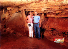
Natural Bridge Caverns, an incredible underground world of natural beauty.

TEXAS WILD FLOWERS

Friday, May 6, 2011

Our Last Job of 2010 Christmas Tree Sales

Our 25 foot flocked Christmas Tree stood next to the main street through Paso Robles. The tree had to be flocked 3 times do to rain storms that came during December.


These folks have been selling there trees here for 25 years. Their tree farm is located near Woodburn, OR.


Part of the lot between the street and the sales tent.


My picture are not of a good quality because I had lost my lens cap and had to remove the filter because it was dirty, I didn't think about adjusting the white balance.

There is not snow on the ground.


The lot we were on was half a city block and we kept about 300 trees up at all times.

Trees ranged in size from table top to 14 feet.

Price was competitive, ranging from $18.00 to $350.00.


Our RV parked behind the sales tent. About the middle of the lot.

We spent most of our time on the lot with one day a week off except for the last week. Actually a short week with very little sales.

With us at the lot were 3 guys from the tree farm, they took care of the tree. setting up the trees, giving them a fresh cut, and taking them to cars.


Inside the sales tent. We had syrup, jam, and seasonal decorations for sale.


Also inside the tent were 15 to 20 flocked trees.


T


All trees sale were completed in the sales tent. Customers were also offered popcorn, coffee, and apple cyder.

We sold over 1500 trees, a 7.5% increase over 2009.


A couple of the guys were quite the sculptures. They would cut the trees in some of the most different ways. Using trees that were damaged or had a problem that made them less valuable.

We referred to them as Charlie Brown trees.
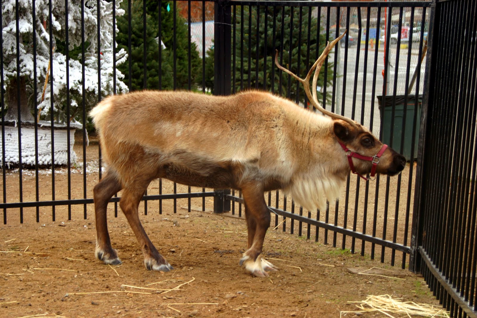


The younger of two reindeer that spent a week with us. They were also at the other two Hopper Bros. tree lots.

In North America it is also called caribou.
Caribou is a sub-species of reindeer.


This one caused all kinds of trouble at our lot in Santa Maria, or should I say off our lot. She got away from the people who were supposed to load them into the tailor to take them to Paso Robles.

Wednesday, April 20, 2011

Part 1 Sugar Beets What We Did

We reported for work the last week end of Sept. 2010. While they were in a hurry to get us there by the week end they put off our orientation until Monday, as the weather had been to warm to harvest.

Starting several days later at the Powder River Piling station. Shown here is piler number one, the smaller piler at our station with only one lane.


Trucks lined up at the larger piler that could handle semis.

Eileen and I worked this piler.


The semis we unloaded came in two types the dump type shown here and one with a large plunger that went the full length of the trailer.

These and the many of the dump trucks unloaded on our right lane.


Here a truck is unloading on our left lane.

The yellow boom swings back and forth in an effort to keep the pile level left to right.


After some training I became the piler operator. This is the pusher rig and I had to signal the driver when to stop and start the the ram. To many beets in the hopper and they spill out. To slow and there are gaps going up the main raiser.


Eileen in front of the skid steer she had to use at the end of the day to clean up our area.


Our piler and work station for the month of October. The beets go in the hoppers on the left end of the picture and out the yellow boom on the right. The green booms on either side of the piler are for the tare.(the dirt shook of the beets and loaded back in the trucks.)


Our view up the Yellowstone River. If you click on the picture it will in large to full screen. You will then find a Bald Eagle siting in the dead tree at this end of the island.


One of the sun sets we were treated to.


At sun rise the moon is setting.

Part 2 Sugar Beets


Russ the piling supervisor for Sidney Sugar and us with piler in the background.


Our foreman Don ,back to us, and the maintenance man for 3 piling stations. When something goes wrong you hope you can fix it yourself, it could be a number of hours before help would arrive. Jeff one of the growers was a lot of help also.


The rest of the Powder River crew, except for Kay who took the picture. Next to Eileen is Nita and Dwain and next to me is the operator of the smaller piler.


About sugar beets , average size of beet is about the size of your head. Eileen found out that they hurt if they fall on your head.


Many of them longer than your foot.


The blue dot in the middle of the beet is the water soluble case the seeds are coated with. The seeds are encased to facilitate sewing of the seeds in a uniform manner. Sugar Beet seeds are grown in the Willamette Valley in Oregon.


This 17 inch sugar beet was one of the largest harvested last year.


These, ranging from 10 to 14 inches are very common.


From the cat walk on top of the piler looking over the nearly completed pile. Driving around the pile was 1/4 of a mile. Size of the pile is roughly the area of a football field 25 feet high.


This is the weigh station. Kay's work place. All trucks stop here twice being weighed in and out.

There is a tradition of those who find a red beet are to take it to the weigh station for a kiss, Kay made it quite clear she was not kissing any of us. So Eileen and I took some red beets, placed them on her desk and covered them with candy kisses at the near the end of the season. Kay then gave a kiss to all who passed her station the next day.

So in one month from a harvest of 986 acres requiring 1749 truck loads we piled about 31,000 tons of sugar beets at the Powder River piling station. Test were taken daily from all trucks and all growers to determine the sugar contented, over all the average sugar Continent for our station was 31.4%.

Thursday, March 31, 2011

Badlands National Park


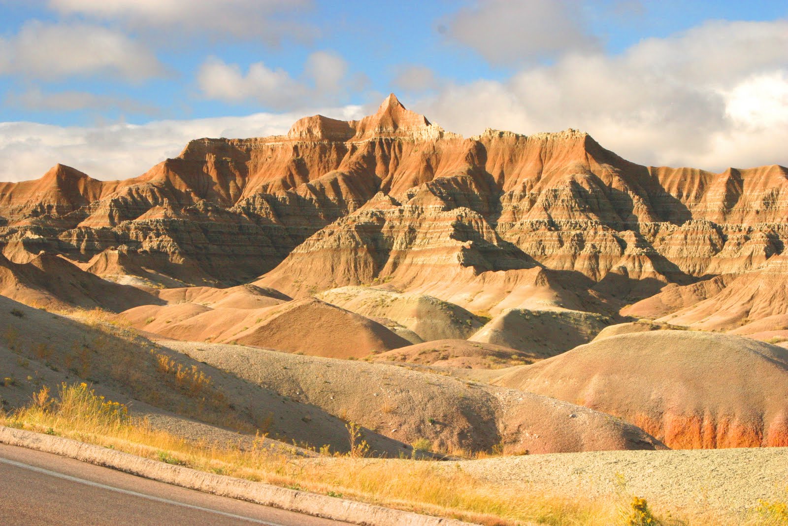
Canyons, spires, and flat-topped tables the serrated badlands terrain started eroding about 500,000 years ago. Given another 500,000 years and there will be nothing but mixed grass prairie.


We did not pick the best day for our visit to the park. The sun did brake through the clouds from time to time giving us some great contrast.


Since we were coming from Hot Springs we came in a back way across the Pine Ridge Indian Reservation.


The road across the north part of the park is not paved making for a messy trip, but our friend Bill McNew would be proud of the van even if it is not 4 wheel drive.


Looking across the badlands you see some formations reminiscent of Bryce canyon. Different geology but erosion and disposition is the same.


From sea bottom to yellow soil, later a river flood plain then sandstone deposits. Finally 28 to 30 million years ago a thick layer of volcanic ash was deposited. Volcanic eruptions to the west continued to supply ash by wind and water.


So 75 million years of layers and 1 million years of erosion and its strung out from here to the gulf of Mexico.


Since we entered via Sage Creek Road we came across Roberts Prairie Dog Town. We also saw a Bison, but only one at quite a distance.


These guys on the other hand were all over the place. Bighorn Sheep, all have horns but the females do not have the larger horns the the males have.


These may also have been younger Bighorn Sheep.


Wind, rain, and freeze/thaw action have gradually worn down the land, leaving the Badlands Wall behind.


While colorful, all of the layers till a story about climate, vegetation, and animal life.


Wall, South Dakota takes its name from the Badlands Wall.


With upheavals in the land the black ocean mud is exposed to the air. Upper layers were weathered into a yellow soil.


We found the answer to the question, Where in the hell is Wall Drug.

Friday, March 25, 2011

The Black Hills Wild Horse Sanctuary


The Sanctuary is located 14 miles south of Hot Springs, SD.


Dayton O. Hyde, founder and president Institute of Range and the American Mustang. Dayton is a rancher, photographer and author of 17 books.


For nearly 20 years the Sanctuary has been a private setting for western movie making. Shot on-location here include Hidalgo and Crazy Horse. Seen here is the 1870s Fort Robinson set.


11,000 acres of pristine prairie with wild horses everywhere.


A small part of the more than 500 wild mustangs here at the Sanctuary.


To see more horses at the Sanctuary check out this link. http://www.wildmustangs.com/slideshow.html


Bird nests on an outcropping of some sandstone cliffs.


People have been writing on sandstone since the beginning of time.


1897 might not seem that long ago.


Native American petrogylphs.


Not just for wild horses, how about some wild turkeys. The Toms are showing there stuff.


For more about the Sanctuary its founder and the horses try this website. http://www.wildmustangs.com/